


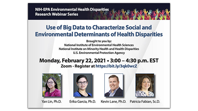
Use of Big Data to Characterize Social and Environmental Determinants of Health Disparities
Moderators: Jonathan Levy, Professor, Boston University and Nishadi Rajapakse, Program Director, Division of Scientific Programs, NIMHD
| Time | Event |
|---|---|
| 3:00-3:05 p.m. |
Introduction to the Environmental Health Disparities Webinar Series |
| 3:05-3:25 p.m. | A GIS-based Environmental Mapping of Potential Abandoned Uranium Mine Contamination on the Navajo Nation, USA Center Affiliation: Center for Native American Environmental Health Equity Research Presenter: Yan Lin, Assistant Professor, University of New Mexico |
| 3:25-3:45 p.m. |
Disparities in COVID-19 Mortality in California by Race/Ethnicity and Ethnicity/Nativity |
| 3:45-4:05 p.m. |
Developing a Geographic Information System to Study Social and Environmental Determinants of Health |
| 4:05-4:30 p.m. |
Discussion and Questions & Answers |
NIH-EPA Environmental Health Disparities Research Webinar Series
Part 01 - Intro and Presentation #1

Part 02 - Presentation #2

Part 03 - Presentation #3
Part 04 - Q&A and Closing

Abstracts
A GIS-based environmental mapping of potential abandoned uranium mine contamination on the Navajo Nation, USA
Investigators: Yan Lin (PI), Joseph Hoover and Esther Erdei, University of New Mexico
Abstract: Native American communities in the Western United States have direct and frequent contact with metal mixtures from unremediated abandoned uranium and other hardrock mine sites. This research created a geospatial model to examine potential exposure to environmental contamination from abandoned uranium mines (AUMs), of which there are 523 on the Navajo Nation (NN). The Navajo Nation is a sovereign indigenous Tribal nation in the southwestern states of New Mexico, Arizona, and Utah. Previous health studies articulated multiple human health hazards associated with AUMs and multiple environmental mechanisms/pathways (e.g., air, water, and soil) for contaminant transport. Despite this evidence, the existing research investigating the spatial distribution of AUM contamination relies primarily on proximity to mines and considers single rather than combined pathways of exposure. This can hinder implementation of Tribal public health policies and action plans mitigating health effects associated with AUMs. Therefore, we sought to further understanding of the spatial dynamics of contaminant exposure potential across the NN. We used GIS-based multi-criteria decision analysis (GIS-MCDA), fuzzy logic, and analytic hierarchy process (AHP) to develop an environmental exposure potential raster surface. Eight criteria layers were selected for the GIS-MCDA model: proximity to AUMs, roadway proximity, drainage proximity, topographic landforms, wind index, topographic wind exposure, vegetation index, and groundwater contamination. Model sensitivity was evaluated, and statistical validation analysis was conducted using two separate environmental datasets. Model results were strongly associated with environmental uranium concentrations compiled from the National Uranium Resources and Evaluation dataset and assessed using Geographically Weighted Regression. The sensitivity analysis indicated consistency and reliability of the model. The model classified 20.2% of the NN as high potential for AUM contamination while 65.7% and 14.1% of the region were at medium and low risk, respectively. This study is a novel application of GIS MDCA for AUMs and a crucial step informing ongoing environmental health disparities research and remediation efforts to reduce human exposure to AUM waste.
Disparities in COVID-19 Mortality in California by Race/Ethnicity and Ethnicity/Nativity
Investigators: Erika Garcia, Assistant Professor, University of Southern California (MADRES Center)
Abstract: There is mounting evidence of the coronavirus disease 2019 (COVID-19) having disproportionate impacts in historically marginalized groups in the United States. Identifying COVID-19 disparities is an initial step towards mitigating disease impacts in vulnerable communities. Using death certificate data from California (CA), we conducted an epidemiologic study examining characteristics of COVID-19 decedents and evaluating for disproportionate mortality across racial/ethnic groups and by combinations of ethnicity and nativity. COVID-19 deaths were identified using an internally developed algorithm. Age-adjusted mortality rate ratios (MRR) were compared across racial/ethnic groups. Proportionate mortality rates (PMR), which compare ratios of COVID-19 mortality in a specified subpopulation to all-cause mortality in the same sub-population, were compared across racial/ethnic groups and by ethnicity and nativity combined. We identified 10,200 COVID-19 deaths occurring in CA between February 1 and July 31, 2020. Decedents tended to be older, male, Hispanic, foreign-born, and have lower educational attainment. MRR indicated elevated COVID-19 morality rates among Asian/Pacific Islander, Black, and Hispanic groups compared with the White group, with Black and Hispanic groups having the highest MRR at 2.75 (95%CI:2.54-2.97) and 4.18 (95%CI: 3.99-4.37), respectively. Age-specific MRR revealed greater disparities, particularly for younger Black and Hispanic individuals. Among those aged 20 to 54 years: for Black individuals MRR=4.68 (95%CI:3.50-6.26) and for Hispanic individuals MRR=8.48 (95%CI:6.92-10.39). Similar results were observed with PMR, which remained in analyses stratified by education. Elevated PMR were observed in all ethnicity/nativity groups, especially foreign-born Hispanic individuals, relative to U.S.-born non-Hispanic individuals, were generally larger for younger age groups, and persisted after stratifying by educational attainment. Differential COVID-19 mortality was observed in California across racial/ethnic groups and by ethnicity/nativity groups with evidence of greater disparities among younger age groups. Public health interventions should consider the interplay between structural, social, and individual factors contributing to these disparities to effectively mitigate the impacts of this disease.
Developing a Geographic Information System to Study Social and Environmental Determinants of Health
Investigators: Kevin Lane, Assistant Professor, Boston University School of Public Health and Patricia Fabian, Associate Professor, Boston University School of Public Health
Abstract: As part of the Center for Research on Environmental and Social Stressors in Housing Across the Life Course (CRESSH), we built a detailed geospatial database of individual, residential, and neighborhood characteristics, which included sociodemographic, built environment, social stressor characteristics, and environmental exposures. The data are available at geographic resolutions ranging from parcel to census-tract level. We used these datasets to construct indexes for home leakiness, environmental quality, and heat vulnerability, which allowed for characterization of spatial patterns of exposure and corresponding environmental health disparities. In addition, our geospatial data were combined with geocoded COVID-19 case data in Massachusetts and novel datasets characterizing time-activity patterns to help determine root causes of racial disparities.